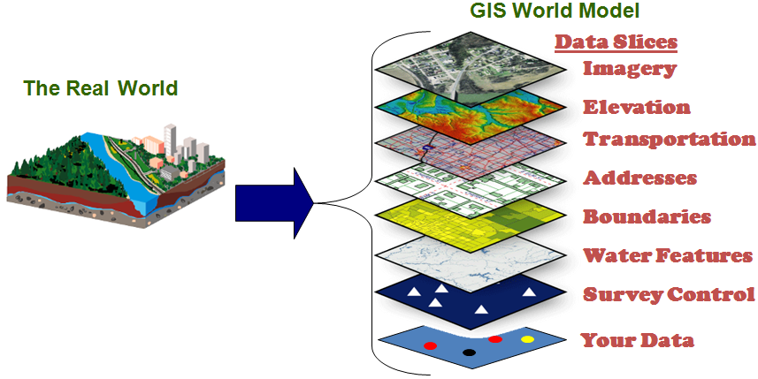
A geographic Information system (GIS) is a program that enables us to collect, manage, store, analyze and present data. GIS is embedded in the geographic sciences and promotes the visualization of patterns, relationships and events by analyzing spatial locations and using layers of information. QGIS is an Open Source program under the GNU General Public License and is maintained and updated by a group of volunteers.